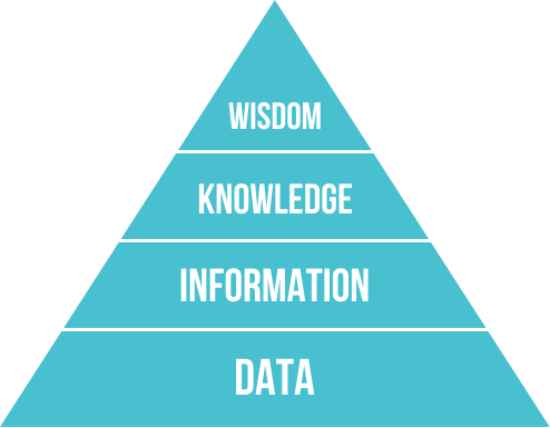
From data to wisdom: informing MSP and EUSAIR implementation in the Adriatic Ionian Region
Alessandro Sarretta, Chiara Venier, Andrea Barbanti, Stefano Menegon, Daniel Depellegrin
(CNR-ISMAR)
Twitter: @Tools4MSP
The role of Marxan in multi-objective Marine Spatial Planning:Building capacity to ADRIATIC+
5 th to 9 th of September, 2016 - Veli Lošinj, Croatia
MSP as a challenge for science-to-policy
Knowledge needed as:
- Conceptual and methodological approaches
- Knowledge of system functioning at different spatial scales and with time
- Data and tools to support decisions
“MSP is a practical way to create and establish a more rational organization of the use of marine space and the interactions between its uses, to balance demands for development with the need to protect marine ecosystems, and to achieve social and economic objectives in an open and planned way.”Ehler and Douvere, 2009
 Why ISMAR is interested and involved in MSP
- ISMAR has multiples science competences:
- Ecology/Biology
- Oceanography
- Modelling
- Geology
- Data management
- "Vertical" in-depth knowledge
- "Horizontal" integration
| PROJECT | TOPIC |
|---|---|
| ADRIPLAN (DG MARE) finished | Transboundary implementation of MSP in AIR |
| RITMARE IV (Italian Ministry of Research and Education funds) ongoing | Development of tools for MSP; MSP for EUSAIR implementation |
| MUSES (H2020 programme CSA) -starting on 1st October 2016 | Multi-use in European Seas |
| BLUEMED CSA (H2020 programme) starting | Research Agenda on Blue Growth-MSP |
| JPI OCEANS JOINT ACTION ongoing | Research Agenda on Blue Growth-MSP |
| SUPREME, SIMWESTMED (call EASME) | Support to MSPD implementation in the Mediterranean Sea |
| PORTODIMARE (Adrion programme) under evaluation | Development of tools for MSP |
| CO-EVOLVE (MED programme) under evaluation | Coastal and maritime tourism |
| MANTIS (DG MARE) ongoing | Sustainable fishery |
| AMARE (Med programme) under evaluation | Marine Protected Areas |
ADRIPLAN project 
ADRiatic Ionian maritime spatial PLANning
(www.adriplan.eu)
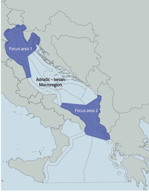
- EU funded project to develop MSP in the Adriatic-Ionian Macroregion
- December 2013 - July 2015
- Transboundary (4 countries: Croatia, Italy, Slovenia, Greece), 8 Scientific Partners and 9 Institutional Partners, 17 observers
- Proposals and recommendations for an operational cross-border MSP process
ADRIPLAN methodology
Guideline to be replicated for other MSP case studies in the AIR and Mediterranean area of study, to be adapted at different scale

Main outputs
- Methodological framework
- Initial Assessment for the AIR
- Analysis of coexistence and compatibility among uses, cumulative impacts, socio-economic analysis for the AIR and the two Focus Areas
- Strategic Plan for the Adriatic-Ionian Macroregion
- Portfolio of Actions for the Focus Areas
- Stakeholders involvement
- Interoperable Geospatial Data Portal for MSP and Adriplan Data Policy document
- Tools4MSP (Conflict Scores and Cumulative Impacts)
Open access archived ADRIPLAN reports
- Lipizer, Marina et al.. (2014). ADRIPLAN Data Policy. Zenodo. 10.5281/zenodo.50862
- Barbanti, Andrea et al. (2015). ADRIPLAN Conclusions and Recommendations: A short manual for MSP implementation in the Adriatic-Ionian Region (English edition). Zenodo. 10.5281/zenodo.49190
- Barbanti, Andrea et al.. (2015). Developing a Maritime Spatial Plan for the Adriatic Ionian Region. Zenodo. 10.5281/zenodo.48231
Synthesis map of environmental protection
Strategic zoning for the Adriatic Ionian Region
Pilot action for Focus Area 1
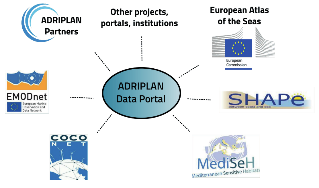
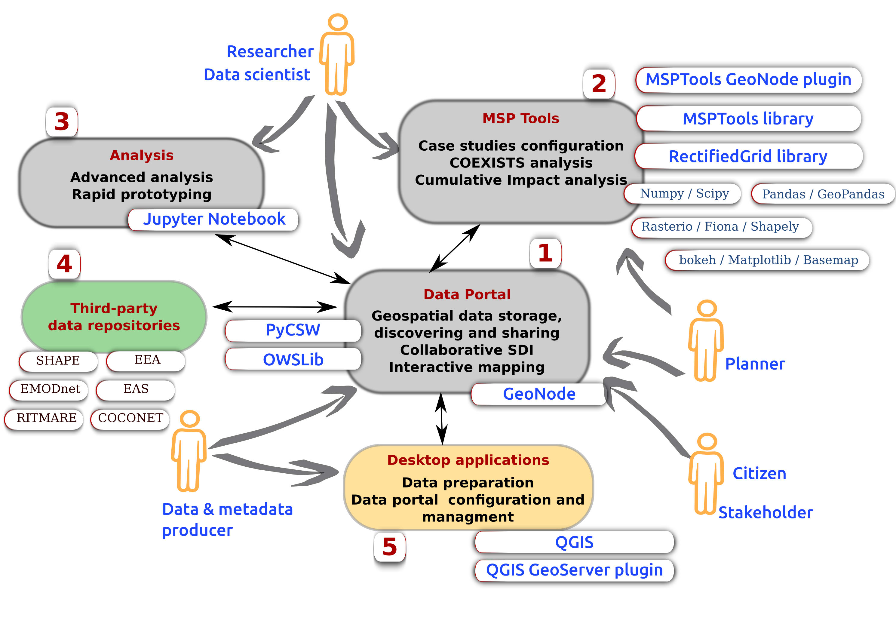
Adriplan Data Portal
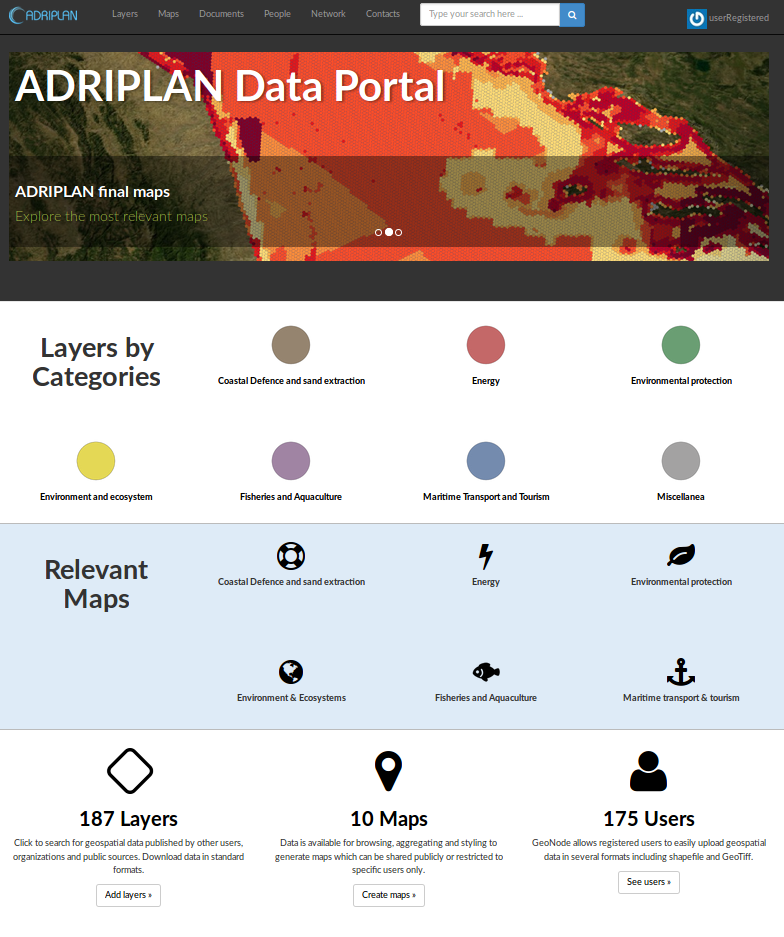
- Collecting and making available MSP data in ADRIPLAN
- Tool to be used by partners collaboratively for:
- Discover, view and access available data through metadata
- Create maps merging available data
- Download data to be used in the project
- Populate the data portal with new data
- Incremental implementation during the project
- User (group) profiles to customize interaction and availability of data
- Opensource tools: modular and extensible for development of specific functionalities
Adriplan Data Portal - What's inside
- ~150 vector layers (points, lines,areas)
- ~50 rasters layers (images, models, interpolations)
- ~60 maps (combination of layers)
- Other hundreds of layers through standard OGC-services
- ~60 users
Data portal access and use statistics
Our focus: tools supporting MSP
- Moving from data inventory, to integration within the ADRIPLAN methodology, to supporting tool for MSP planning
- Use, customization, development, integration in the Portal
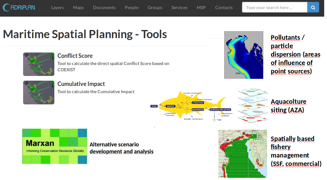
Types of MSP tools
Identifying spatial interactions between activities
Risk assessment of cumulative effects of human pressures
Decision support systems
Web-based vs. GIS-based tools
Designed for different users (programmer, scientist, strategic planner, case officer, public),
To address different stages of the plan
Tools4MSP
|
“Stefano Menegon et al. 2016. Open source tools to support Integrated Coastal Management and Maritime Spatial Planning. DOI: 10.7287/peerj.preprints.2245v1 |
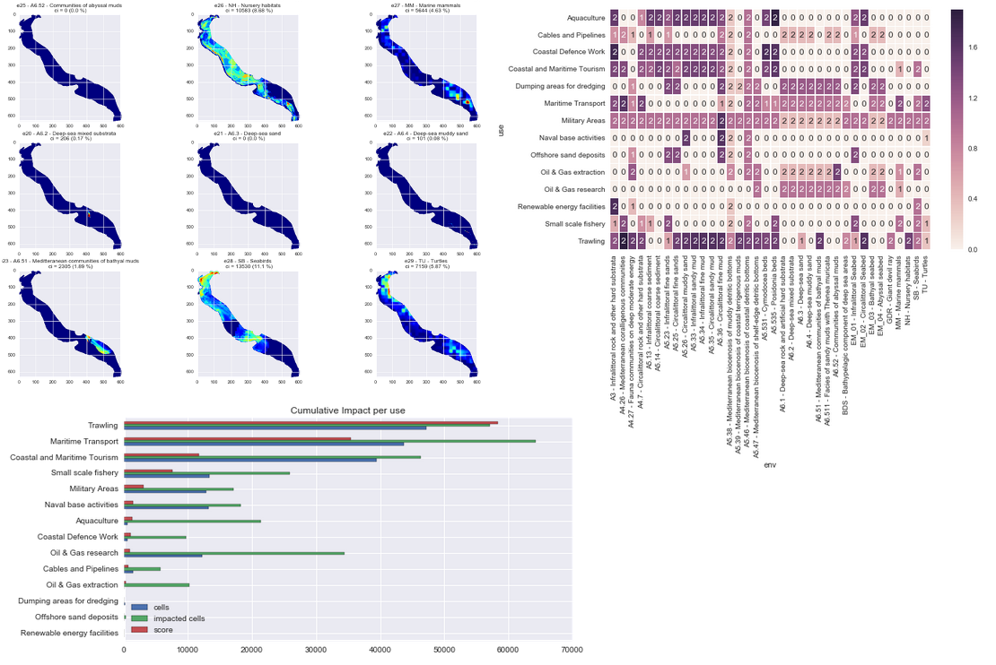
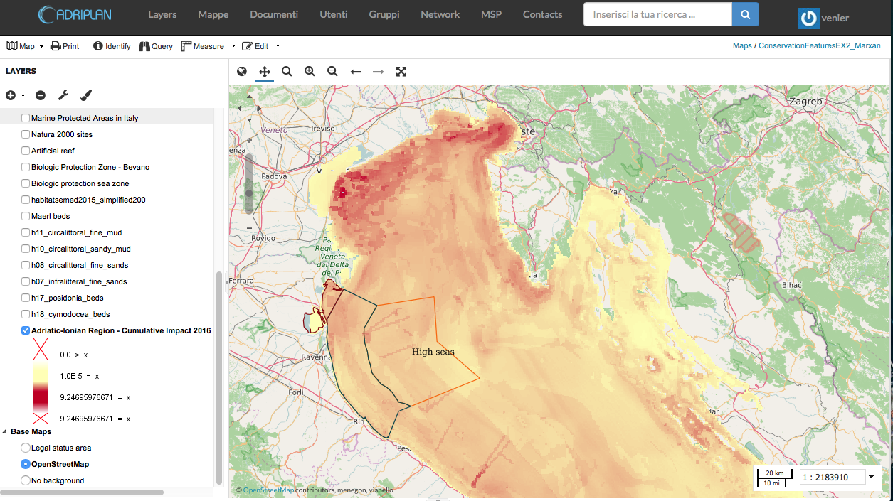
Tool4MSP - Cumulative impact
Identify areas in the marine space where the environmental components are more exposed to anthropogenic pressures
- Activities and uses (e.g. Maritime transport)
- Environmental components (e.g. Marine mammals)
- Pressures (e.g. Underwater noise)
- Sensitivities: the sensitivity of each environmental component to each pressure generated by a maritime use
firstly introduced by Halpern et al. (2008) at global scale, then implemented in several Marine Regions (Mediterranean by Micheli et al. (2013), Baltic Sea by (Korpinen et al., 2013), and North Sea (Andersen et al., 2013)).
Extended data and visual reports
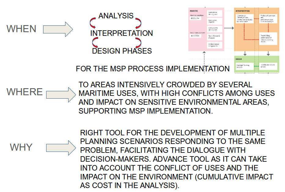
Marxan implementation to the Adriatic-Ionian Region
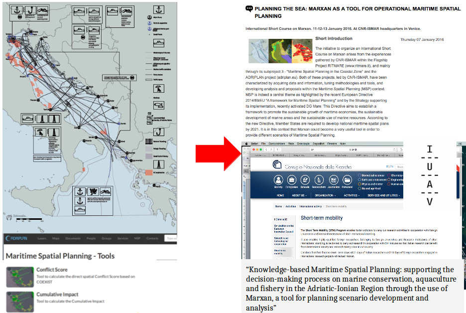
when, where and why we use Marxan?
PROPOSED FRAMEWORK for the Adriatic-Ionian region case study
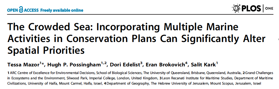
adapted from Mazor et al., 2014. The Crowded Sea: Incorporating Multiple Marine Activities in Conservation Plans Can Significantly Alter Spatial Priorities. PLoS ONE 9, DOI: 10.1371/journal.pone.0104489
- STEP 1= description of the study area in different scales and relative main issues (on the basis of Adriplan results, issues, priorities and needs), answering to the need to apply systematic approaches at various scales (Giakoumi et al., 2012)
- STEP 2= definition of the aim of the analysis to be realized carrying out different case studies (on conservation protection and on major economic marine activities for the area)
- STEP 3= definition of conservation features, costs, targets for each case study
- STEP 4= collecting and pre-processing data layers for creating the input datasets
- STEP 5= implementation of the spatial prioritization tool: running Marxan for the different case studies on different domains
- STEP 6=evaluate trade-offs/development of planning scenarios to discuss with stakeholders
- STEP 7= rerun with different targets
- STEP 8= final portfolio of planning scenarios ready for discussion with decision-makers. The final plans will meet biodiversity targets; will achieve economic objectives, while minimize costs.
Study area
Domain 1 Adriatic-Ionian Region
Domain 2 Italian side of the AIR
Study area
Domain 3 Marine waters of Emilia Romagna Region
General aim of the analysis
On the basis of the peculiarities of the AIR (EUSAIR pillars), the following priorities, both in terms of environmental protection and socio-economy productivity, have been identified for the areas of study:
- Protection of the environment: in line with MSFD (e.g. protecting at least 10% of the seabed is currently exploited by trawling) and Biodiversity Convention (increasing the 10% of marine areas);
- Sustainable development of aquaculture (also focusing on the proposal for new offshore areas between 3nm and 12 nm);
- Sustainable development of fisheries (both commercial and artisanal);
- Sustainable development of tourism: guaranteed by the previous 3 points as well as preserving transport and sand deposits activities (specific activity for the Emilia Romagna region), as important activities of the area.
Specific aim of the analysis
Specific objectives will be achieved by developing specific case studies:
- Identifying priority areas to design networks of MPAs for biodiversity conservation;
- Identifying priority areas to design aquaculture farms, favouring in particular offshore sites.

Conservation features 1
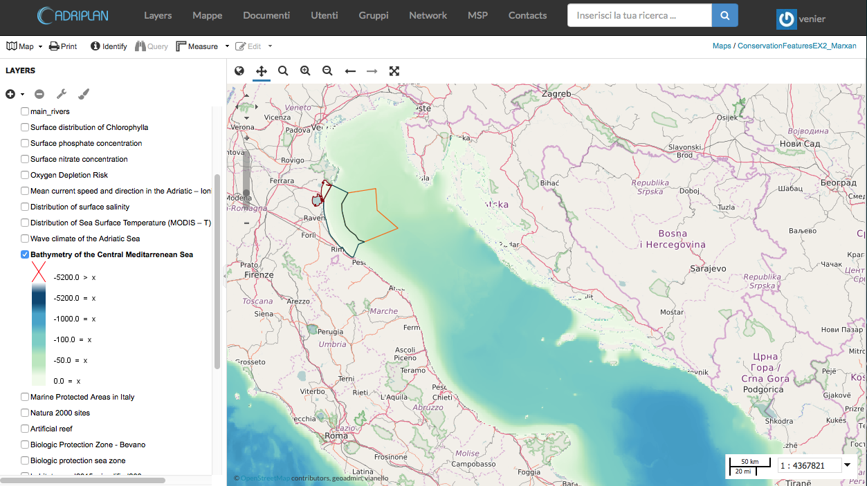
Conservation features 2
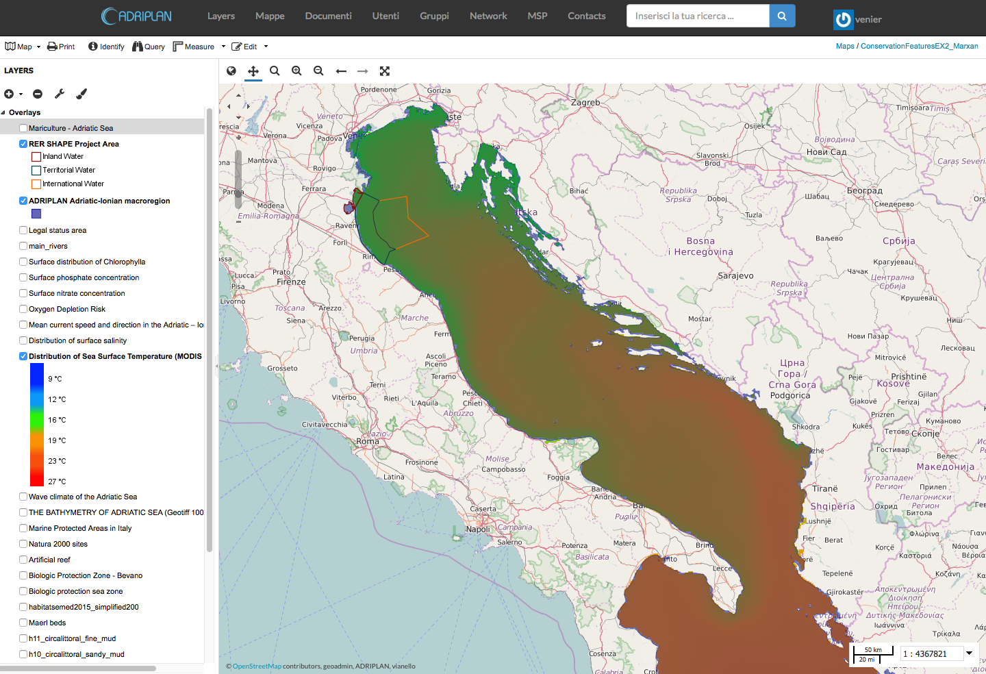
Conservation features 3
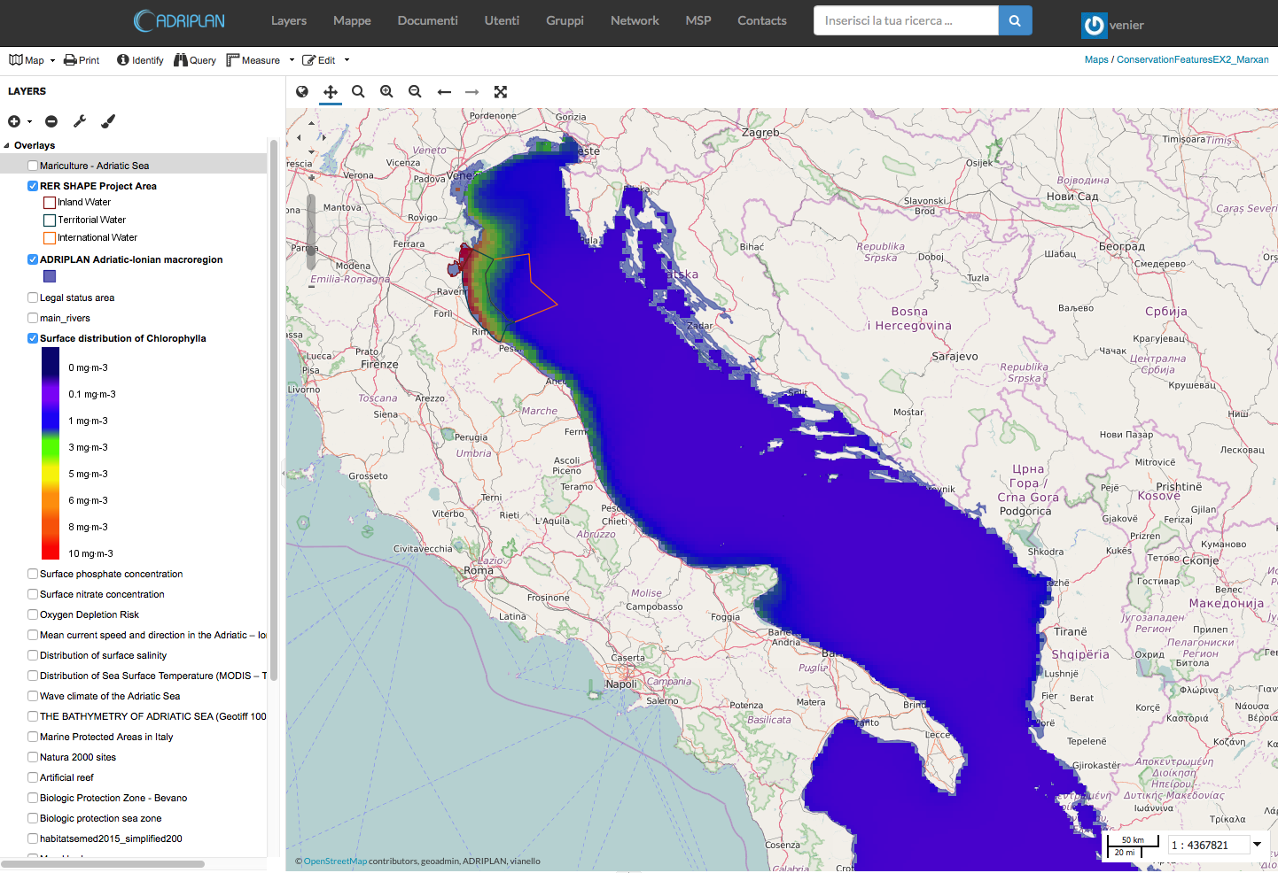
Costs
Lessons we are learning on the use of Marxan
- stakeholders/expert involvement for the finalization of the problem, the observation of specific data/thresholds, and in-depth literature review
- consider the time required to observe and elaborate data (pre-processing phase)
- importance of a tool for data collection and management (Adriplan Data Portal)
- need for a clear definition of the problem and of the goals (it was useful to start from the Adriplan experience, as well as to adopt the workflow of Mazor et al., 2014)
- different approach for the biodiversity conservation and aquaculture analyses
From data to wisdom: informing MSP and EUSAIR implementation in the Adriatic Ionian Region
by A. Sarretta, C. Venier, A. Barbanti, S. Menegon, D. Depellegrin is licensed under a Creative Commons Attribution 4.0 International License.
It can be viewed online here and downloaded here.
To cite this work please refer to:
“Alessandro Sarretta, Chiara Venier, Andrea Barbanti, Stefano Menegon, Daniel Depellegrin (2016). From data to wisdom: informing MSP and EUSAIR implementation in the Adriatic Ionian Region. DOI: 10.6084/m9.figshare.3806703